The Value of Floodplains
Large-scale floodplain restoration and conservation in the Mississippi River system warrants significant investment, and the FP Tool can help guide these investments.
Restoring or conserving floodplains will help:
Improve Water Quality. When inundated with water, floodplains act as natural filters, removing excess sediment and nutrients like nitrogen and phosphorous, which can degrade water quality and increase treatment costs. Research shows restored and reconnected floodplains can remove, on average, 40 percent of the nutrients they intercept.
- A University of Notre Dame study shows that 30,000 acres of restored floodplain habitat along Indiana’s Wabash River, a critical tributary of the Mississippi and a significant source of nutrient pollution, is removing more than 19 million pounds of nutrients and capturing 360 million pounds of sediment each year.
- TNC studies in Wisconsin have shown that floodplains with healthy wetlands remove an average of about 60 lbs/acre of nitrogen.
 Reduce Flood Impacts. Floodplains are places where water can disperse during floods, which reduces pressure on manmade protection structures like levees and dams and reduces risk for nearby communities and agricultural lands.
- Lower Flood Insurance and Disaster Recovery Costs. The U.S. spends an average of $3.1 billion on flood insurance premiums each year and $4 billion in crop insurance subsidies. Identifying and protecting or restoring regularly inundated areas posing the highest flood risk can reduce the consequences of flooding—loss of life, structures and crops—and reduce repetitive economic losses to society.
- It has been estimated that restoring the 100-year flood zone of the five-state Upper Mississippi River Basin could store 39 million acre-feet of floodwaters—the same volume that caused the Great Flood of 1993—and save over $16 billion in flood damage costs.
- Just one acre of wetlands can hold about 1 million gallons of water—more than an Olympic-size swimming pool—reducing impacts on communities during floods.
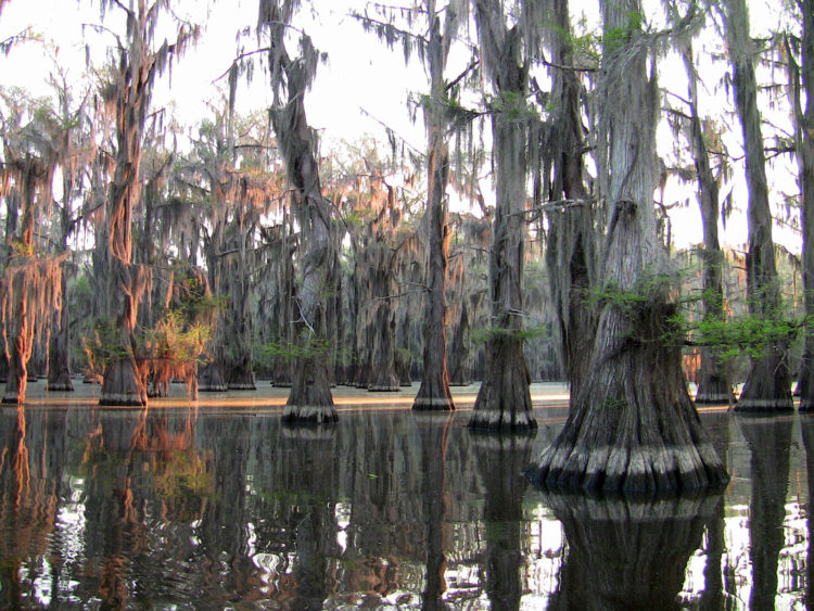
Enhance Wildlife Habitat. Floodplain forests and marshes are among the richest habitats for wildlife, both in terms of diversity and numbers. Within these areas, species like fish and waterfowl thrive, benefiting important commercial and recreational industries. For example, the Mississippi River Flyway is globally significant, as it provides critical habitat for more than 325 bird species.
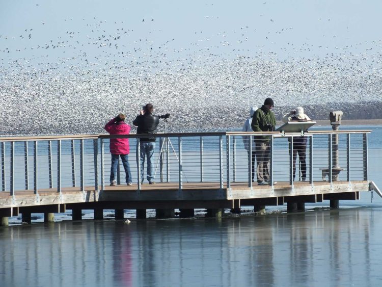 Provide Better Recreational Opportunities. Many outdoor recreational activities—like fishing, hunting, camping, hiking, wildlife watching and boating—are made possible or greatly enhanced by the natural processes of rivers and healthy floodplains. Combined, these recreational activities account for billions of dollars in economic activity in the United States and are important sources of income for most nations around the globe.
Recharge Aquifers. Outside of a river’s main channel, water flow is slowed and has more time to seep into the ground where it can replenish underground water sources (or aquifers), which serve as a primary source of drinking water for many communities and irrigation for the region’s crops.
Unfortunately, our incredibly important floodplains are at risk.
Tens of millions of acres of floodplains across the Mississippi River Basin have been developed or converted to agriculture. These changes in land use have degraded water quality, increased flood impacts, and threatened habitat for fish and wildlife, all of which takes a toll on the economy and the quality of life for people. For instance:
Water Quality Issues.
- Each year, massive amounts of nutrients—primarily nitrogen and phosphorus—flow down the Mississippi River and empty into the Gulf of Mexico, where they stimulate an overgrowth of toxic algal blooms that create an oxygen-depleted “Dead Zone” where little to no aquatic wildlife can survive. This annual summer event hampers recreation and tourism and jeopardizes the region’s $2.8 billion a year fisheries industry.
- The impacts of nutrient pollution are present—and sometimes devastating—before the water reaches the Gulf of Mexico. For instance, an algal bloom on the Ohio River in the summer of 2017 affected some 600 river miles and communities in four states for more than two months. It forced Cincinnati to spend more than $7,000 per day in additional chemical treatments to its drinking water.
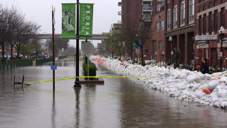 Increased Flood Impacts.
- Average flood losses in the U.S. now approach $10 billion annually, driving the taxpayer-funded National Flood Insurance Program at least $20 billion in debt.
- Since 2000, nearly half of the major river floods not caused by coastal surges in the U.S. have taken place within the Mississippi River Basin. Source. (20 of 42 as of May 2019.)
- 2018 was one of the wettest recorded years in the Mississippi River Basin, with annual records set in a number of places, especially Minnesota. Also, several basin states experienced “top 10” years for precipitation, but it appears 2019 may be worse. Source.
- A 2018 study co-authored by Conservancy staff found that current flood maps significantly underestimate the risk of flooding rivers across the U.S. The study revealed that more than 41 million people are living in areas with a 1% annual chance of flooding, which is far greater than the 13 million indicated by the existing FEMA maps.
Photo credits this page ~ Main image: Robert J. Hurt; Top in-page photo: Jay Harrod/TNC; Middle in-page photo: Doug Blodgett/TNC; Bottom in-page photo: Jay Harrod/TNC