• Facebook
  • X
  • Support Us
Freshwater Network - The Nature Conservancy
  • About Us
    • Who We Are
    • What We Do
    • Support Us
    • Contact Us
  • Innovative Tools
    • Overview
    • Freshwater Resilience
    • Floodplain Prioritization Tools
    • Conservation Delivery Application
    • Water Quality Resource Inventory
    • Flow Modeling
    • Channelization
    • Oysterflows
  • Projects
    • Overview
    • Floodplain Prioritization Tools
    • Aquatic Barrier Prioritization
    • Wetlands By Design
    • Freshwater Assessments
    • Wetland Monitoring
    • Florida Freshwater
    • Natural Solutions Toolkit
    • AI For Conservation
  • Additional Resources
  • Get Involved
Select Page

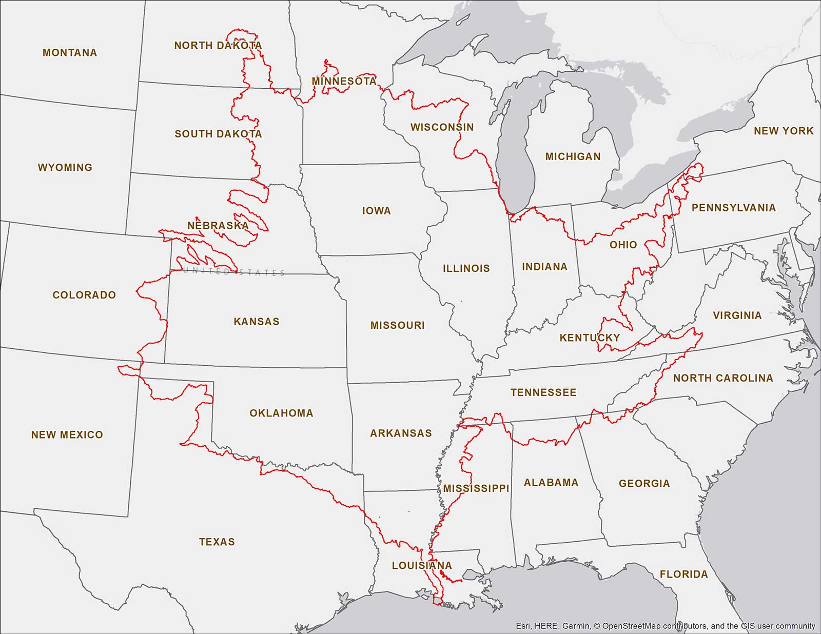
Map of Current Coverage

The FP Tool’s current extent, outlined in red, covers most of the Mississippi River Basin and touches down in 24 states. TNC is working with partners to expand its coverage. If you have a need for the FP Tool within the Mississippi River Basin but outside of its current coverage (or if you have other related questions) email TNC’s Kris Johnson.

About the Floodplain Prioritization Tool

  • Mississippi River Basin Floodplain Tool
    • Who is it for?
    • Fact Sheet
    • Feature Story
    • Coverage Map
    • The Value of Floodplains
    • User Training Video
    • Email TNC’s Kris Johnson
    • Media Info
    • Launch the FP Tool (IE not supported)
    • Technical Specifications & Data Layers
  • Lower Meramec River Floodplain Tool
    • Launch the FP Tool (IE not supported)
  • Western Tennessee Floodplain Tool
    • Launch the FP Tool (IE not supported)
    • Technical Specifications & Data Layers
  • Kentucky Floodplain Tool
    • Launch the FP Tool (IE not supported)
    • Technical Specifications & Data Layers
  • Trinity River Floodplain Tool
    • Launch the FP Tool (IE not supported)
    • Technical Specifications & Data Layers
    • User Training Video
  • Facebook
  • X

nature.org© 2019 The Nature Conservancy | Legal Disclosure | Privacy Statement